Geospatial Data
Geospatial data object containing a spatial reference in the form of coordinates. Often these are geocoordinate with the coordinate reference system srid:EPSG:4326.
Obtaining useful Data
A useful resource for geospatial data about Hamburg is GeoPortal. (Other cities/countries have their own agencies, such as the Federal Office of Statistics, that provide local, geospatial data). Follow these steps to obtain raster- and vector-layer data at GeoPortal Hamburg:
- Click on Themen → Fachdaten
- From the list, choose the type of information you wish to obtain raster- or vector-data on and click the information icon next to it.
- In the info card that pops up click on
WMSaddress if available. - If not available, then click on
Weitere Metadaten. This will forward you to metaver.de (MetadatenVerbund).- On Metaver, click on one of the links under
VerweiseorWeitere Verweise.
- On Metaver, click on one of the links under
- You will be directed to a site that contains an XML document. Copy the site's URL and paste it into QGIS to display the geodata.
Prepare Data
LIFE can consume multiple geospatial data format such as GeoJSON (*.geojson), GeoPackage (*.gpgk), GraphML (*.graphml) or ESRI Shapefile (*.shp) as for vector layers, or Raster CSV (*.csv), ASCII Grid (*.asc) for raster-layer.
To prepare non-conforming geospatial data for your model, you can convert it with QGIS as a useful public GIS processing tool.
- Download and install QGIS.
- Load your geospatial data into the QGIS application. This will produce one or more layer(s) in the Layer window (bottom left).
- Export the layer by opening the context-entries and selecting
Export. - Select an appropriate format, mentioned above or described here.
Geospatial Data Types
The MARS runtime system is able to work with process geoinformation and geodata in multiple formats. Upon execution of a simulation, the data stored in such files are converted to graphs, consisting of nodes and edges.
GeoJSON
GeoJSON is a format for encoding a variety of geographic data structures. Typically, a set of data structures is held within a FeatureCollection made up of Features:
{ "type": "FeatureCollection",
  "features": [
    { "type": "Feature",
      "geometry": {"type": "Point", "coordinates": [102.0, 0.5]},
      "properties": {"prop0": "value0"}
    },
    { "type": "Feature",
	  "geometry": {
        // insert geometry types here
      }
    },
    { "type": "Feature",
      "geometry": {
        // insert geometry types here
      }
    }
  ]
}
Below is a description of the geometry types supported in GeoJSON:
Point: a single point on a coordinate system.
Example:
{
    "type": "Point",
    "coordinates": [30, 10]
}
LineString: a set of points connected by lines.
{
    "type": "LineString",
    "coordinates": [
        [30, 10], [10, 30], [40, 40]
    ]
}
The key coordinates contains a set of points, each of which connects to the one listed before it.
Polygon: a set of points connected by lines that form a closed shape.
{
    "type": "Polygon",
    "coordinates": [
        [[35, 10], [45, 45], [15, 40], [10, 20], [35, 10]],
        [[20, 30], [35, 35], [30, 20], [20, 30]]
    ]
}
This is an example of a polygon within a polygon, creating a cut-out within the outer polygon. It is also possible to create a single filled-out polygon.
MultiPoint: a set of multiple unconnected points.
{
    "type": "MultiPoint",
    "coordinates": [
        [10, 40], [40, 30], [20, 20], [30, 10]
    ]
}
MultiLineString: a set of multiple lines made up of multiple points.
{
    "type": "MultiLineString",
    "coordinates": [
        [[10, 10], [20, 20], [10, 40]],
        [[40, 40], [30, 30], [40, 20], [30, 10]]
    ]
}
MultiPolygon: a set of polygons.
{
    "type": "MultiPolygon",
    "coordinates": [
        [
            [[40, 40], [20, 45], [45, 30], [40, 40]]
        ],
        [
            [[20, 35], [10, 30], [10, 10], [30, 5], [45, 20], [20, 35]],
            [[30, 20], [20, 15], [20, 25], [30, 20]]
        ]
    ]
}
Here are examples of how these geometry types are represented visually:
| Point | LineString | Polygon | MultiPoint | MultiLineString | MultiPolygon |
|---|---|---|---|---|---|
 |  | 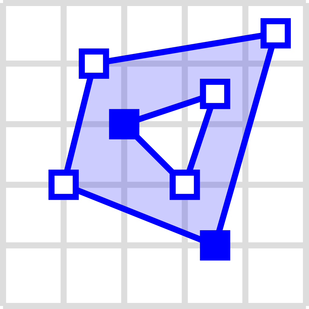 |  | 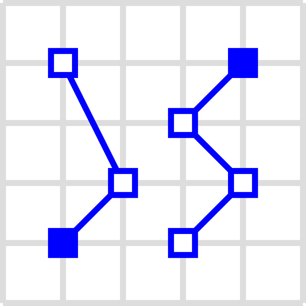 | 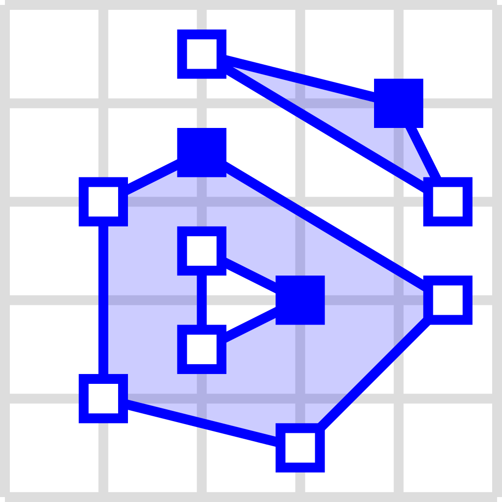 |
For more information on GeoJSON, please visit RFC7946 or https://datatracker.ietf.org/wg/geojson/charter/.
GraphML
GraphML is an XML-based data format for representing graphs. For example, MARS can use geodata from a GraphML file to populate a VectorLayer or other layer type for agents to move on.
GraphML files that contain geodata can be generated using OSMnx. A useful tutorial on how to work with OSMnx can be found here.
GraphML cannot be visualized in QGIS.
Shapefile
Shapefile is a geospatial vector data format for GIS software that is also used within MARS runtime system models. They consist of multiple files, three of which are mandatory:
.shp: shape format; the feature geometry itself.shx: shape index format; a positional index of the feature geometry to allow seeking forwards and backwards quickly.dbf: attribute format; columnar attributes for each shape, in dBase IV format
For more information on Shapefile specifications, please see the ESRI technical description.
Geopackage
GeoPackage is an open, standards-based, platform-independent, portable, compact format for transferring geospatial information. It contains data and geodata in a SQLite database file. For more information, please see the Geopackage homepage.